Categories
GIS Mapping

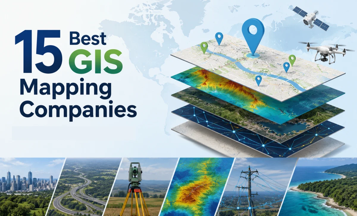
15 Best GIS Mapping Companies Ranked by Expertise

If you have ever tried to find the best GIS mapping company in India, you already know how confusing it can get. There are hundreds of names online, and most of them claim to be the “best” at something. So how do you actually figure out which one is worth your time and your budget?

That is exactly what this article is for. We have gone through project portfolios, client work, service range, and industry reputation to put together a list of the 15 best GIS mapping companies working in India today. Whether you are a government body looking for large-scale surveys, a real estate firm that needs land parcel data, or a private business trying to make sense of geo-tagged data, this list should help you shortlist the right partner.

Before we get into the list, let’s quickly talk about what actually makes a company good at this job, because “best GIS mapping company” means different things to different people.

What Makes a Company the Best GIS Mapping Company

A good GIS mapping company does more than just draw boundaries on a map. It combines field surveys, satellite imagery, drone data, and software tools like ArcGIS and QGIS to turn raw location information into something you can actually use for planning and decision-making.

There are a few things worth checking before you hire anyone. First, look at their technical team. GIS work needs trained surveyors, GIS analysts, and software specialists who know how to handle large datasets without messing up accuracy. Second, check their project history. A company that has worked on utility mapping, land records, or smart city projects will usually understand the practical problems that come up in the field, not just the theory. Third, ask about their data accuracy and how they validate it, since even a small error in spatial data can cause real problems later, especially in land or infrastructure projects.

One more thing that matters a lot in 2026 is how well a company handles geo-tagged data. With more government schemes and private projects asking for geo-tagging of assets, whether that is street lights, water pipelines, or agricultural land, companies that can collect, tag, and manage this data at scale have a real edge over the rest.

With that out of the way, here is our ranked list.

1. Leadtech India

Leadtech India tops this list, and for good reason. As the best GIS Mapping Company, it has built a strong reputation as a reliable GIS mapping company that works across government and private sector projects, including election management systems, infrastructure tracking, and large-scale digital surveys spread across multiple states.

What sets Leadtech apart is the way it combines traditional GIS mapping services with newer tools like AI-based analytics and real-time dashboards. This means clients are not just getting a static map at the end of a project. They get a system that keeps updating and gives them useful insights as new data comes in. The company also has trained field teams and certified data specialists who are used to working with high-volume datasets, which matters a lot when a project involves thousands of data points across a state or region.

Leadtech India has also positioned itself as a dependable geo-tagging company in India, handling asset-level geo tagged data for infrastructure and public sector clients. For organizations that want a partner who can scale from a small pilot project to a state-wide rollout, Leadtech is a strong first choice.

2. RMSI

RMSI is one of the oldest and most established names in India’s GIS industry. The company has decades of experience working on GIS mapping services for telecom, insurance, and natural resource sectors. RMSI is well known for its work in risk mapping and asset tracking, and it has handled projects for clients outside India as well, which says something about the quality of its data and processes.

3. Genesys International

Genesys International has made a name for itself in 3D mapping and LiDAR surveys. The company has worked on several smart city projects in India and is known for building large spatial databases that can support everything from road mapping to city planning. If your project needs highly detailed 3D data, Genesys is one of the companies worth talking to.

4. Esri India

Esri India is the company behind ArcGIS, one of the most widely used GIS software platforms in the world. Beyond just selling software, Esri India also works directly with government departments, urban planners, and large enterprises to build GIS platforms for asset tracking, land management, and smart city applications. Because so many professionals across India are trained on ArcGIS, working with Esri India often means smoother integration with other teams and systems.

5. Cyient

Cyient offers a mix of engineering, digital, and geospatial services, with a strong focus on telecom, utilities, and transportation. The company has global experience, which helps when a project needs to follow international data standards. Cyient’s GIS teams are known for handling complex infrastructure mapping projects without losing accuracy at scale.

6. MapmyIndia (CE Info Systems)

MapmyIndia is on no. 6 of our best GIS Mapping Company list. The company is probably the most recognizable name on this list for regular consumers, thanks to its navigation and mapping apps. But the company also runs a serious GIS mapping services business, providing location intelligence for logistics, vehicle tracking, and asset monitoring. Its strength lies in a huge digital map database that has been built and refined over many years.

7. Rolta

Rolta has worked extensively in defense, infrastructure, and government projects, building GIS-based asset management systems for sectors like utilities and oil and gas. The company’s long history with sensitive and high-stakes projects means it tends to follow strict data handling and security practices, which matters for government clients in particular.

8. Tech Mahindra

Tech Mahindra brings its telecom and IT background into its GIS offerings, focusing on network mapping and infrastructure monitoring for large enterprise clients. For businesses that already use Tech Mahindra for other IT services, adding GIS mapping to the same relationship can simplify vendor management.

9. Lepton Software

Lepton Software focuses on geospatial intelligence and location analytics, helping businesses use spatial data for better decision-making rather than just producing maps. The company has built partnerships with several industry players and positions itself as a location intelligence specialist rather than a traditional mapping firm.

10. GeoCentroid Private Limited

GeoCentroid is a consulting firm that works across GIS, digital photogrammetry, UAV data processing, and LiDAR mapping. The company has carved out a solid position in infrastructure and urban planning projects, where precision and technical consulting matter as much as raw data collection.

11. NeoGeo

NeoGeo works with government and corporate clients, focusing on geospatial intelligence for risk mitigation and resource management. The company’s remote sensing and data acquisition services are built around helping clients make data-driven decisions rather than just delivering maps as a one-time product.

12. GIS Consortium India

GIS Consortium specializes in mapping, imaging, and data processing, with a focus on newer digital mapping technology. The company has built a reputation around innovative approaches to common GIS challenges, which makes it a good option for clients who want more than a standard mapping deliverable.

13. Geoinfra Technologies India

Geoinfra Technologies India stands out because it combines GIS mapping services with a training institute, running both online and offline courses in GIS and remote sensing. The company works across environment, urban planning, agriculture, mining, and water management sectors, and its use of drone technology alongside traditional GIS tools has strengthened its position in construction and mining projects as well.

14. Mavdrones

Mavdrones has built its name at the intersection of drone technology and GIS. As one of the best GIS Mapping Company, it uses drone-based data collection to deliver high-resolution, real-time spatial data, which is becoming increasingly popular for projects that need fast turnaround without compromising on accuracy. This drone-GIS combination is one of the bigger trends in the industry heading into 2026.

15. Geo Adithya (MAPe IT Solutions)

Geo Adithya, operating under MAPe IT Solutions, has built a strong track record in GIS data conversion and utility mapping. The company is particularly known for subsurface utility mapping, which helps construction teams avoid damaging underground electrical, water, gas, or telecom lines during excavation. For clients with a specific need around utility and cadastral mapping, this is a company worth shortlisting.

Why GIS Mapping Services Matter More Than Ever in 2026

GIS is no longer a niche technical service used only by government departments and large corporations. As of 2026, GIS mapping services are being used across agriculture, real estate, logistics, disaster management, and even retail location planning. India’s push toward digitized land records and smart city infrastructure has created steady demand for companies that can collect, process, and manage geo tagged data accurately and at scale.

The National Spatial Data Infrastructure framework has also pushed companies to follow clearer standards when handling spatial data, which is good news for anyone hiring a GIS partner, since it means there is more accountability around data quality than there used to be. At the same time, the combination of drone surveys, AI-based analytics, and traditional GIS tools has made it possible to complete projects faster without giving up on precision, something that was much harder to achieve even five years ago.

For businesses and government bodies working with a geo tagging company India, this shift means better outcomes are possible, but it also means it is more important than ever to pick a partner with real technical depth rather than just a sales pitch.

How to Choose the Right GIS Mapping Company for Your Project

Picking from this list depends a lot on what you actually need. If your project involves government-scale data collection or election-related mapping, a company like Leadtech India, with its experience in large public-sector rollouts, makes sense. If you need deep software integration, Esri India’s platform expertise is hard to beat. For drone-based rapid surveys, Mavdrones or Geoinfra Technologies India might be a better fit.

The most practical approach is to have a short conversation with two or three companies from this list, ask them about a project similar to yours, and see how clearly they can explain their process. A company that can walk you through its data collection, validation, and delivery process in plain language is usually more trustworthy than one that only talks in technical jargon without backing it up.

 

Frequently Asked Questions

Ans. A GIS mapping company collects location-based data using field surveys, satellite imagery, or drones, and then processes that data into maps, databases, and dashboards that organizations can use for planning. This can include anything from mapping land parcels to tracking utility infrastructure across a city.
Ans. Look at their past project experience in your specific sector, ask how they handle data accuracy checks, and find out whether they have handled projects of a similar scale before. A company with government or enterprise clients in a similar domain is usually a safer bet.
Ans. Geo tagged data is information that has been linked to a specific location, usually using GPS coordinates. It matters because it lets organizations track exactly where an asset, event, or piece of infrastructure is located, which is useful for everything from utility maintenance to disaster response planning.
Ans. Yes. Several companies on this list, including Leadtech India, RMSI, and Genesys International, have already worked on state-wide and national-level projects involving large datasets, which shows that Indian GIS firms are well equipped to handle projects of significant scale.
Ans. Costs vary a lot depending on the size of the area, the type of data needed, and whether drone or satellite data collection is required. Smaller projects can be completed in a couple of weeks at a modest cost, while large-scale state or national projects can take months and involve a much bigger budget. It is best to get a custom quote based on your specific project scope.
Categories
GIS Mapping

How the Best GIS Mapping Company Can Help Your Brand

If you’ve ever tried to make a business decision based on location data, figuring out where your customers are, where to open a new store, or how to plan your delivery routes, you already know how complicated it can get. That’s exactly where GIS mapping comes in. And working with the best GIS mapping company for your needs can make that entire process a whole lot simpler, smarter, and more profitable.

In this article, we’re going to break down what GIS mapping actually is, why it matters for businesses today, and how the right GIS mapping company in India or elsewhere can genuinely move the needle for your brand.

What is GIS Mapping, and Why Should Businesses Care?

GIS stands for Geographic Information System. At its core, it’s a technology that captures, stores, analyzes, and displays data tied to specific locations on Earth. Think of it like Google Maps, but far more powerful and tailored for business use.

Instead of just showing you where a place is, GIS mapping layers multiple types of data onto a map, things like population density, sales territories, competitor locations, infrastructure networks, environmental factors, and more. This makes it incredibly useful for businesses that need to understand not just where something is, but why it matters in that location.

According to a report by MarketsandMarkets, the global GIS market was valued at around $8.1 billion in 2020 and is projected to reach $14.5 billion by 2025, growing at a CAGR of 12.4%. That kind of growth tells you a lot about how seriously industries are taking location intelligence right now.

What Does the Best GIS Mapping Company Actually Do?

There’s a big difference between a company that just makes maps and one that truly understands how to use spatial data to solve real business problems. The best GIS mapping company doesn’t just hand you a pretty visual; it helps you interpret that visual and turn it into decisions that save money, attract customers, and reduce risk.

Here’s what a quality GIS mapping partner typically brings to the table.

Location-Based Market Analysis

One of the most common uses of GIS for businesses is understanding the market landscape in a specific area. Whether you’re a retailer looking to expand, a telecom company planning new towers, or a logistics firm optimizing delivery zones, GIS mapping gives you a clear picture of where the opportunity is and where the risks lie. A skilled GIS mapping company in India, for example, can overlay census data, income levels, traffic patterns, and competitor density onto a single map, giving you insights that would take weeks to gather manually.

Territory and Route Planning

For companies with field sales teams, service technicians, or delivery fleets, efficient territory planning can directly impact your bottom line. GIS tools can divide regions intelligently, minimize travel time, balance workloads across teams, and even factor in real-time traffic data. When done well, this kind of spatial planning can cut operational costs significantly. Some businesses report fuel and time savings of 15-20% after implementing GIS-based route optimization.

Customer Segmentation by Geography

Not all your customers are the same, and where they live often tells you a lot about their behavior, preferences, and needs. GIS mapping companies can help you segment your audience geographically so your marketing messages, product offerings, and service plans actually match what’s relevant in each area. This is especially valuable for brands running hyperlocal campaigns or regional launches.

Infrastructure and Asset Management

For industries like utilities, real estate, construction, and government, tracking physical assets across large areas is a constant challenge. GIS mapping gives you a live, spatial view of your infrastructure, pipelines, towers, properties, and equipment, so you can manage maintenance schedules, spot vulnerabilities, and plan future investments with much more confidence.

Disaster Response and Risk Assessment

Businesses in industries like insurance, agriculture, and urban planning use GIS mapping to model risk. Which areas are prone to flooding? Where are the zones most affected by drought? How does proximity to a natural hazard affect property values? These are questions that GIS can answer with accuracy, and having that data upfront can save your brand from costly mistakes.

Why a GIS Mapping Company in India Makes Sense for Global Businesses

India has become one of the strongest hubs for GIS expertise globally. The country has a large pool of trained geospatial professionals, strong technical infrastructure, and competitive pricing, making a GIS mapping company in India an attractive option not just for domestic brands but for international ones as well.

Beyond cost, Indian GIS firms have built deep experience across sectors like agriculture, urban planning, logistics, telecommunications, and retail. Many of them follow international data standards and have worked with multinational clients, so the quality and scale of work are genuinely on par with global competitors.

For Indian businesses specifically, the relevance is even clearer. India’s diverse geography, rapidly growing urban population, and complex infrastructure challenges mean that location intelligence isn’t a luxury; it’s practically a necessity for brands that want to compete seriously.

How to Choose the Best GIS Mapping Company for Your Needs

Finding the right partner isn’t about picking the one with the flashiest website. Here are a few things worth looking at when you’re evaluating GIS mapping companies.

Industry Experience

GIS is used across so many sectors that the tools and approaches can vary significantly. A company that specializes in telecom network planning may not have the same depth for retail site selection. Make sure the firm you’re considering has done work in your industry before, and ask for case studies or examples.

Data Capabilities

The quality of GIS work is only as good as the data behind it. Ask potential partners where they source their spatial data, how frequently it’s updated, and whether they can integrate with your existing data sources. A good GIS mapping company will be transparent about this.

Technology Stack

Leading GIS firms work with industry-standard platforms like Esri’s ArcGIS, QGIS, Google Earth Engine, or MapInfo. They should also be capable of building custom GIS applications if your use case requires it. If a company is using outdated tools or can’t explain their tech stack clearly, that’s a flag.

Communication and Support

You don’t have to become a GIS expert yourself, but your partner should be able to explain what they’re doing in plain language. Good communication is a strong indicator of a trustworthy company, especially for long-term projects.

Real Business Impact: What You Can Expect

When you work with the best GIS mapping company suited to your brand, the impact shows up in concrete ways. Marketing teams make smarter decisions about where to run campaigns. Operations teams cut down on wasted time and fuel. Leadership teams go into expansion decisions with real data instead of gut feeling.

A retail chain that uses GIS to pick store locations, for example, isn’t just placing a pin on a map. They’re looking at foot traffic patterns, competitor proximity, income demographics, and accessibility data all at once. That kind of multi-layered insight significantly reduces the risk of a poor location decision, and those decisions can cost millions if they go wrong.

Similarly, logistics companies that work with GIS mapping firms to design delivery zones often see measurable improvements in on-time delivery rates and customer satisfaction scores. And in agriculture, GIS-based crop monitoring has helped farmers in India improve yield predictions and reduce input costs.

The point is, GIS mapping isn’t a niche tech tool anymore. It’s a practical business asset, and the companies that use it well tend to stay ahead of the ones that don’t.

Ready to Use Location Intelligence for Your Brand?

At LeadTech, we help businesses make sense of their spatial data so they can make smarter, faster decisions. Whether you’re looking to understand your market better, plan your expansion, or simply get a clearer picture of where your customers are, we’re here to help.

Get in touch with us today, and let’s talk about how location intelligence can work for your brand specifically. No complicated tech talk, no one-size-fits-all solutions, just the right data, in the right format, for the decisions that matter to you.

Visit us at leadtech.in.

Frequently Asked Questions (FAQs)

What is a GIS mapping company, and what services do they offer?

A GIS mapping company specializes in collecting, analyzing, and visualizing geographic or location-based data. Their services typically include spatial data analysis, custom map creation, territory planning, market analysis, route optimization, and GIS application development for various industries.

How can GIS mapping specifically benefit my business?

The benefit depends on your industry, but broadly, GIS mapping helps you make better location-based decisions, whether that’s choosing where to open a store, how to route your delivery fleet, how to segment your customer base by geography, or how to manage physical assets spread across large areas.

Why should I consider a GIS mapping company in India?

India has a well-developed pool of GIS talent with experience across industries like logistics, real estate, telecom, agriculture, and urban planning. GIS mapping companies in India often offer high-quality work at competitive pricing, and many have extensive experience working with both domestic and international clients.

How do I know which GIS mapping company is best for my needs?

Look for industry-specific experience, a strong data sourcing approach, use of modern GIS tools like ArcGIS or QGIS, and clear communication. Ask for past case studies and check if they’ve worked with businesses of a similar scale and sector to yours.

Is GIS mapping only for large enterprises, or can small businesses use it too?

GIS mapping is absolutely useful for small and mid-sized businesses. In fact, for local businesses looking to understand their neighborhood market, plan efficient service routes, or target their marketing more precisely, GIS can offer very high value even on a modest budget. Many GIS mapping companies offer scalable solutions depending on your needs and budget.